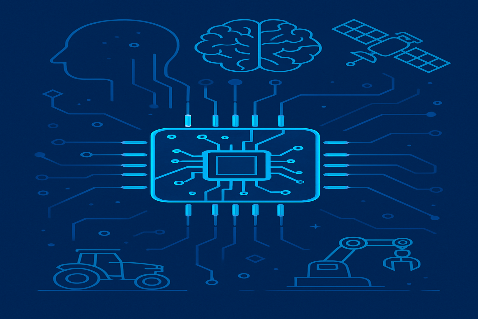
PIXAM.XYZ delivers precision positioning technology for the connected age. Our intelligent GNSS and UWB systems empower you to place live, IoT-enabled sensors on the move — enabling real-time asset tracking, logging, and absolute location, indoors or outdoors. Harness the power of GNSS for wide-area outdoor positioning and UWB for centimetre-level indoor precision. Whether it’s a robot, cart, drone, or container, our platforms simplify complex navigation tasks with unmatched accuracy and scalability. Designed for robotics, logistics, agriculture, and future-ready cities.
Know Your Position. Digitise Your World. Own Your Advantage.
Material Flow & Logistics
- Shop Floor Visibility
- Early Detection of Bottlenecks
- Reliable Traceability for Labour & Assets
- Optimised Routing & Workflow Automation
- Enhanced Safety & Regulatory Compliance
Inventory Visibility & Movement Track
- Ral-time Locations of all objects whether indoor or outdoors
- Preventive Loss
- Movement and Usage Track
- Replenish, Sort and Clean Monitor
- Available 24/7 day and night, Summer & Winter
- Inventory Auto Updates

Airport Trolley Monitoring & Log
- Real-Time Trolley Availability
- Location-Based Analytics
- Optimised Repositioning Routes + usage graphs
- Reduced Retrieval Time
- Convert trolleys to an IoT kinematic analytic tool
- Automatic Alerts & Status Updates
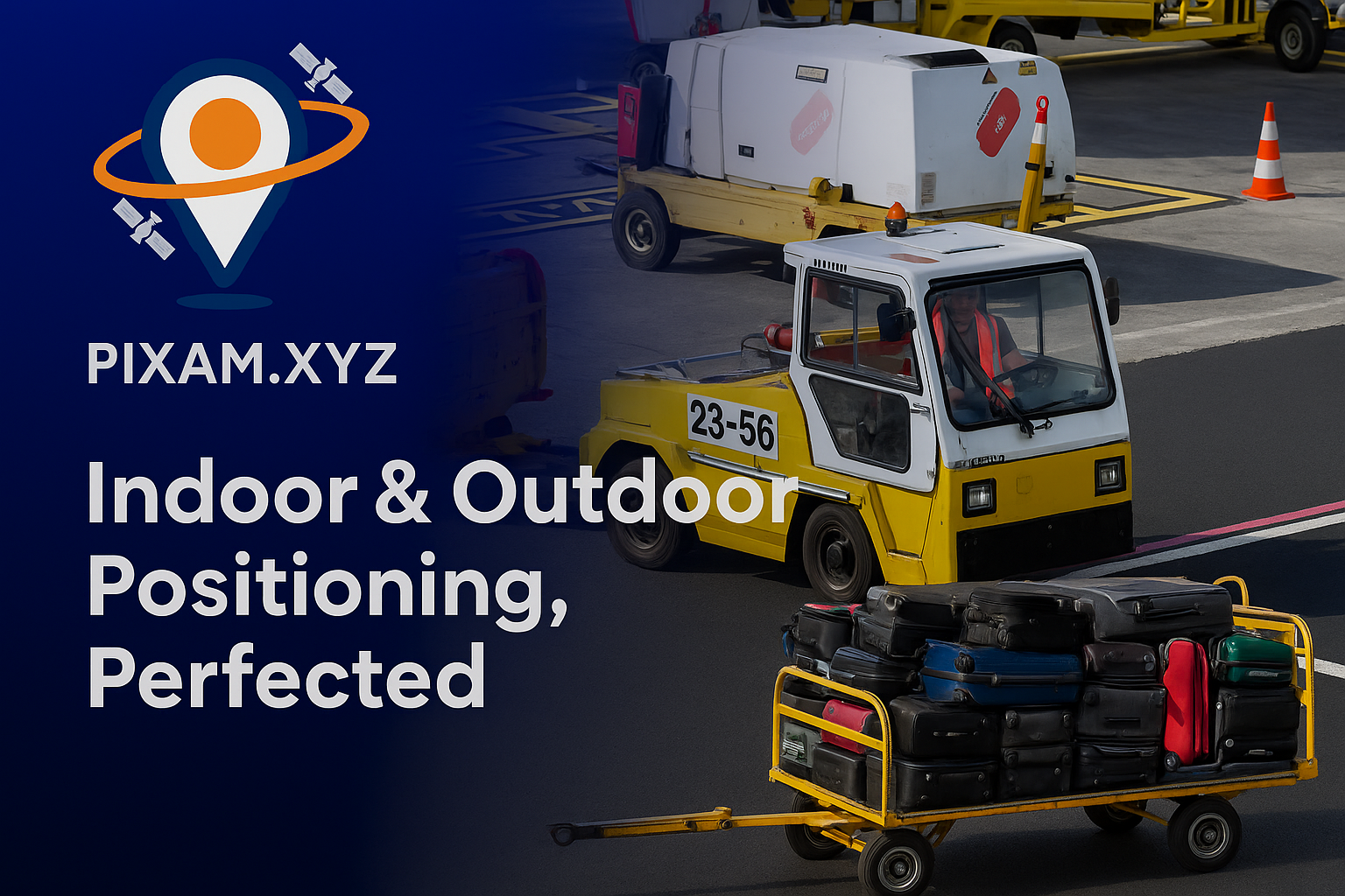
Cargo Handling Operations
- Locate Cargo in Real Time, 24/7
- Ensure Accurate Load Tracking and on time
- Reduce Manual Handling Time
- Minimise Lost or Misplaced Cargo
- Automate Scanning & Check-ins
- Streamlined Loading & Dispatch and monitor delays
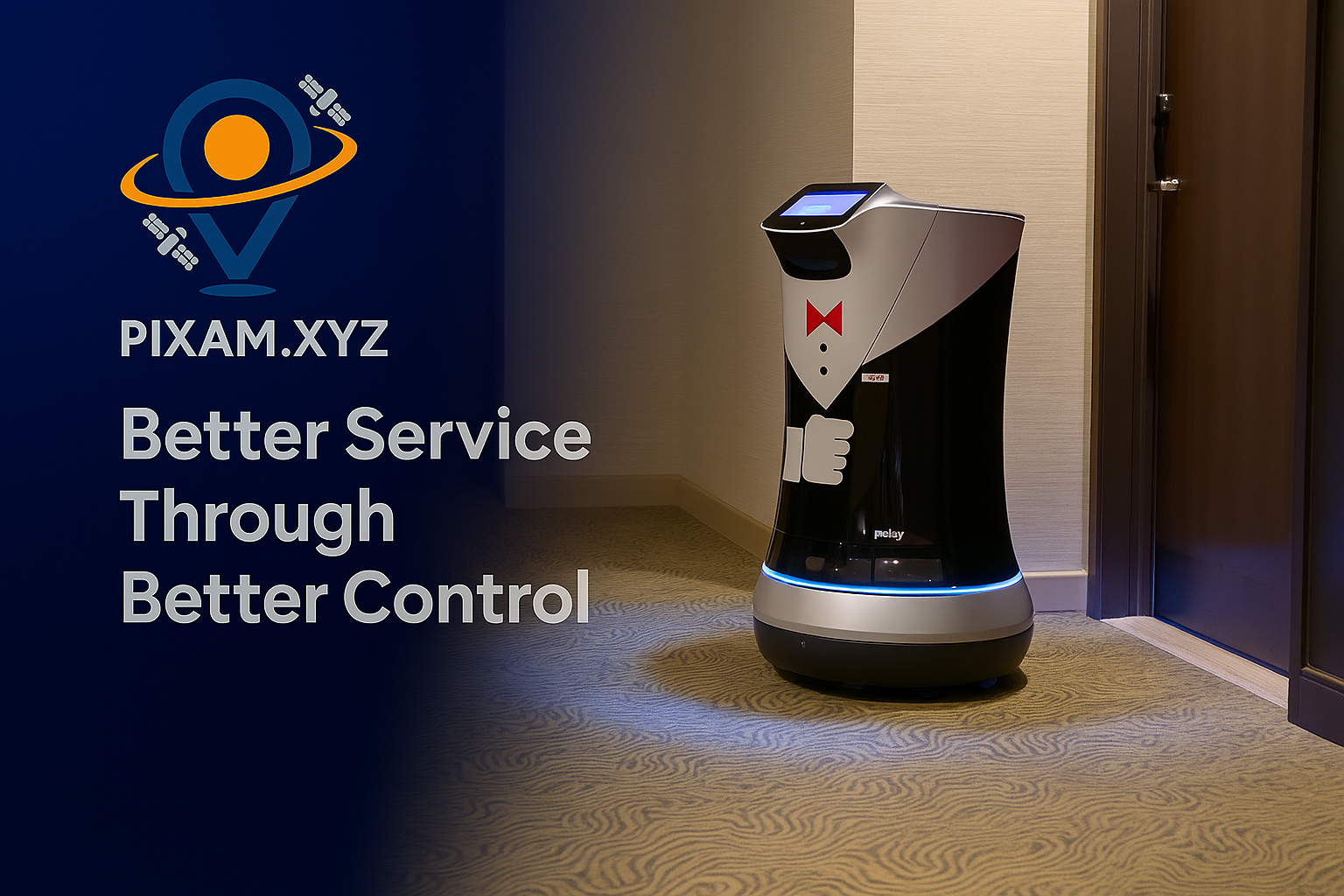
Smarter Hospitality & Better Service
- Enhanced Guest Experience
- Reliable Room-to-Room Delivery-tracking features
- Reduced Staff Workload
- Real-Time Tracking & Control
- Increased Operational Efficiency
- Seamless Integration with Hotel Systems
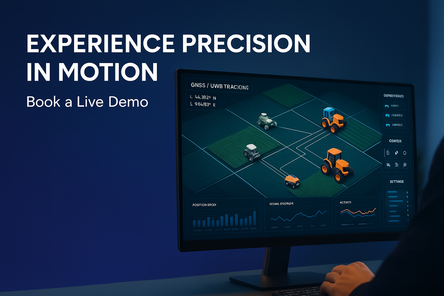
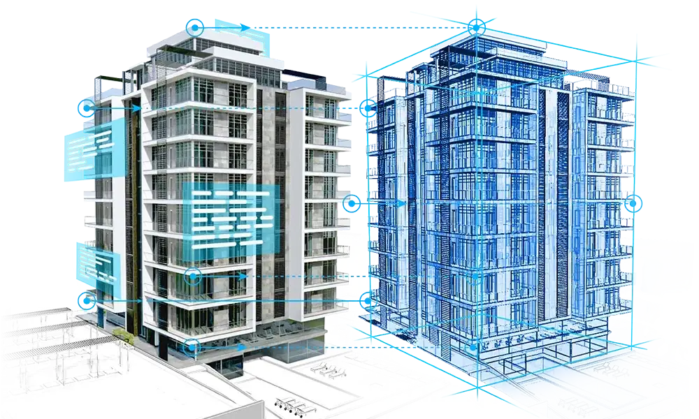
Ultra-Precise
Indoor–Outdoor Positioning for Digital Twin Creation
PIXAM develops smart GNSS and UWB platforms that enable high-resolution spatial awareness for generating reliable digital twins of industrial, agricultural, and urban environments.
OUR POSITIONING-BASED DIGITAL TWIN PLATFORM
- PIXAM’s hybrid system combines GNSS RTK for absolute outdoor accuracy and Ultra-Wideband (UWB) for precise indoor localisation, allowing users to map, measure, and visualise spaces and systems in real time. This enables the seamless creation of interactive, data-rich digital twins for infrastructure, machinery, and mobile assets.
- Purpose-built for complex environments — including factories, greenhouses, farms, and warehouses — PIXAM’s platform ensures centimetre-level positioning, continuous data logging, and smooth integration with CAD, GIS, and simulation software. Our open API and modular architecture allow developers, engineers, and operators to build custom workflows tailored to their domain.
- Whether you're modelling the physical world, monitoring operations, or planning automation, PIXAM empowers you to build and update digital twins with confidence and precision.
PIXAM's visualisation software
PIXAM provides a dynamic, real-time software platform that visualises precise indoor and outdoor positioning data using UWB and GNSS. Our system transforms raw spatial inputs into live digital environments, enabling users to monitor movement, generate digital twins, and analyse operations through an intuitive, customisable interface. Whether you're developing automation workflows, mapping assets, or integrating with external systems, PIXAM’s platform offers flexible visualisation tools and an open API to support seamless integration and expansion.
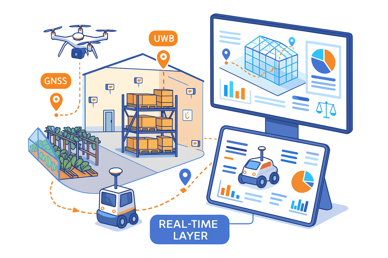
Spatial Analysis
Real-Time GNSS Hardware Logging Platform
At PIXAM, we develop next-generation GNSS GIS tools that bring precision mapping, real-time sensor logging, and absolute spatial positioning to your fingertips. Our integrated platform allows you to visualise, track, and analyse the movement and data of connected devices across indoor and outdoor environments.
Built for Engineers, Developers, Mapping Experts & Field Operators
- PIXAM’s platform, powered by our GNSS hardware, empowers technical teams to log hardware and software events with spatial precision, analyse IoT movement and sensor trends, automate data workflows, and integrate seamlessly with CAD, GIS, and simulation environments
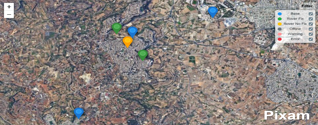
- Every location tells a story — from sensor activity to motion patterns. With PIXAM’s GNSS base station and rover system, spatial data transforms into actionable insight. Whether you're tracking fleet behaviour, monitoring sensor events, creating digital twins, or powering a live dashboard, every movement is logged and visualised — in real time, on the map.
- Whether you're modelling the physical world, monitoring operations, or planning automation, PIXAM empowers you to build and update accurate spatial replicas and data-driven representations with confidence and precision.

PIXAM'S GIS for GNSS
PIXAM's GIS platform seamlessly integrates with its GNSS equipment to enable high-precision mapping, logging, and real-time spatial analysis. It allows users to visualise and manage georeferenced data collected by PIXAM's RTK-enabled rovers and base stations for applications such as field surveying, navigation, and digital twin creation.
COMPLEMENTARY SOFTWARE TOOLS
PIXAM NTRIP Caster:
Our custom-built NTRIP Caster ensures real-time GNSS corrections with robust connectivity and absolute accuracy. Designed for scalability and low latency, PIXAM’s system seamlessly integrates with rover devices across smart agriculture, surveying, robotics, and logistics — no subscription needed, just precision delivered.
Real-Time GNSS Over MQTT:
PIXAM’s MQTT-based GNSS broadcasting system provides real-time correction data directly to rover devices using a lightweight, publish-subscribe model. Ideal for constrained networks and edge computing environments, this approach enables scalable, low-latency positioning without traditional NTRIP infrastructure. Seamlessly integrate into IoT platforms, autonomous systems, and smart field applications — all with open protocols, minimal overhead, and maximum flexibility.
PPK software:
PIXAM’s PPK algorithms offer centimetre-level GNSS correction by processing raw observation data after collection. Users simply upload rover logs to our secure servers, where advanced post-processing aligns them with base station data—either from PIXAM or third-party sources. The system automatically computes precise positions, making it ideal for users working in remote areas or without reliable real-time RTK connectivity.
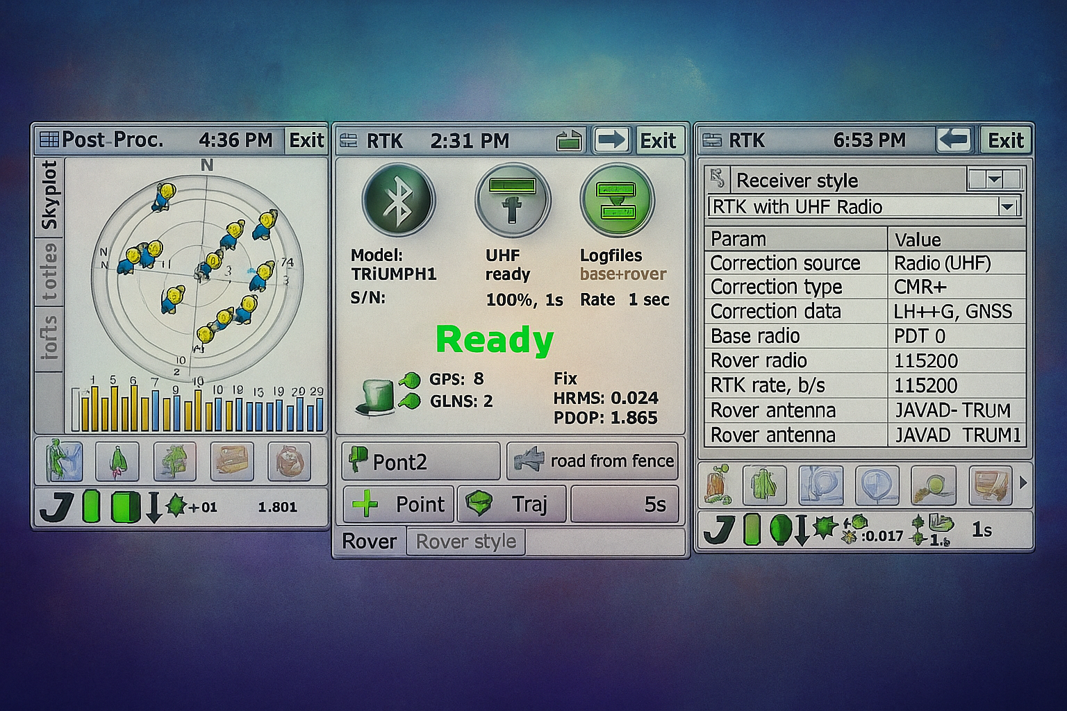
RTK software:
PIXAM’s RTK service delivers real-time centimetre-level positioning by streaming raw GNSS observations from the user’s device to our secure cloud server. The server handles all RTK calculations—eliminating the need for local processing—then sends back corrected positions instantly. This is ideal for mobile robotics, drones, and precision tools where lightweight hardware and reliable accuracy are essential. Whether using a PIXAM base station or a third-party NTRIP source, our server-side RTK ensures fast, accurate results with minimal setup.
RTCM Decode & Encode:
PIXAM’s server supports RTCM decoding and encoding, allowing users to convert live GNSS data into or from standard RTCM 3.x messages. Stream messages to decode them for analysis or debugging, or upload structured data to generate RTCM corrections for rover use. Ideal for developers, integrators, and advanced GNSS workflows.
Hardware
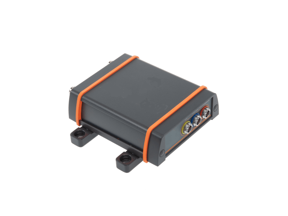
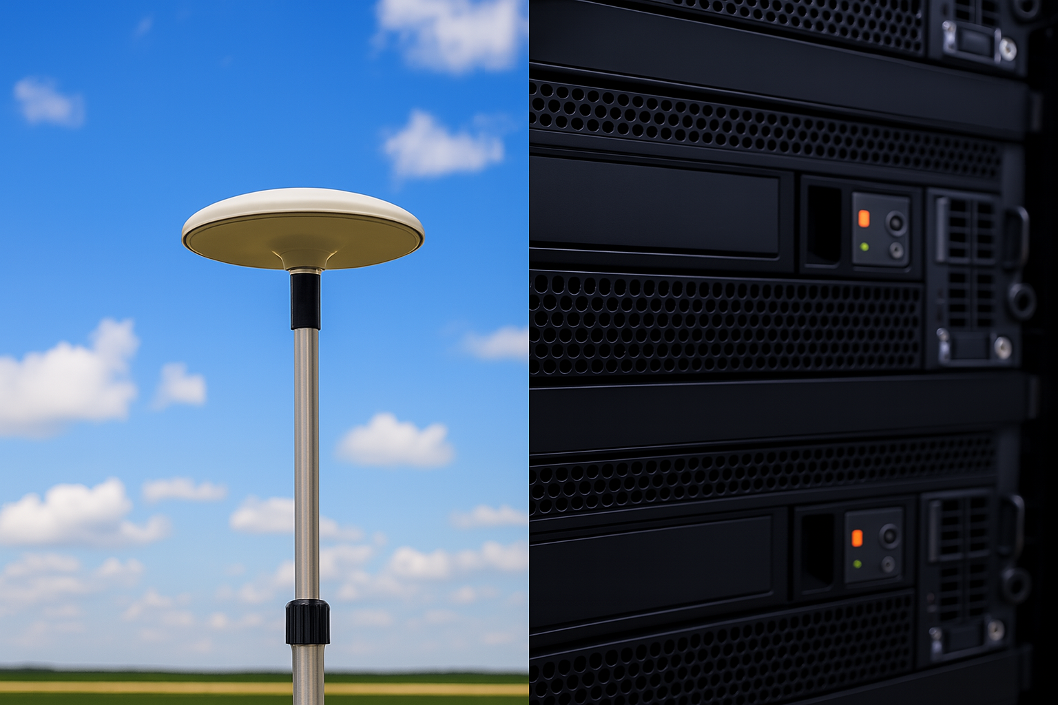
GNSS BASE STATION
Robust top-quality hardware for RTK and differential corrections
- Multi Constellation & Multi-frequency for reliability and performance
- Stop wasting time looking for things with a powerful search & find
- Easy calibration
- Tough and compact IP68 weatherproof housing, ready for deployment
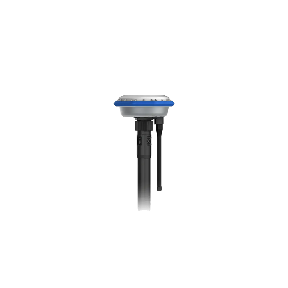
GNSS Rover Unit
Reliable centimeter-level positioning, designed for harsh environment.
- Supporting standard data formats like RTCM, MSM and RINEX
- Advanced multi-frequency, multi-constellation (GPS + GLONASS + Galileo + BeiDou) RTK GNSS performance
- Compatible with any Android device
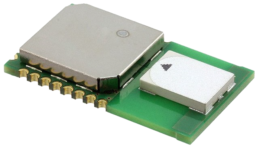
UWB Indoor use
Leverage Indoor Data for Smarter Insights
- Ingest data from proprietary systems, IoT devices, and third-party sources
- Converting fragmented inputs into actionable indoor intelligence
- Enhance indoor experiences through location awareness, and visualize live data
Tailored Technology, Built In-House
From hardware design to final deployment, shaped by real-world needs and one-on-one collaboration.
- We design and build every system in-house — from hardware to software. By keeping development under one roof, PIXAM ensures full control over quality, integration, and performance. Each platform reflects our deep expertise in GNSS, robotics, and real-time systems.
- No two customers are the same — and neither are our solutions. PIXAM follows a customer-by-customer approach, engaging directly with end users to understand their workflows, challenges, and goals. This results in practical, field-ready technology that adapts to real-world demands.
- We build what’s needed — not what’s convenient. Every feature, board, or line of code is shaped by actual use cases. Whether it's precision farming, indoor tracking, or automated logistics, our solutions are driven by needs — not assumptions.